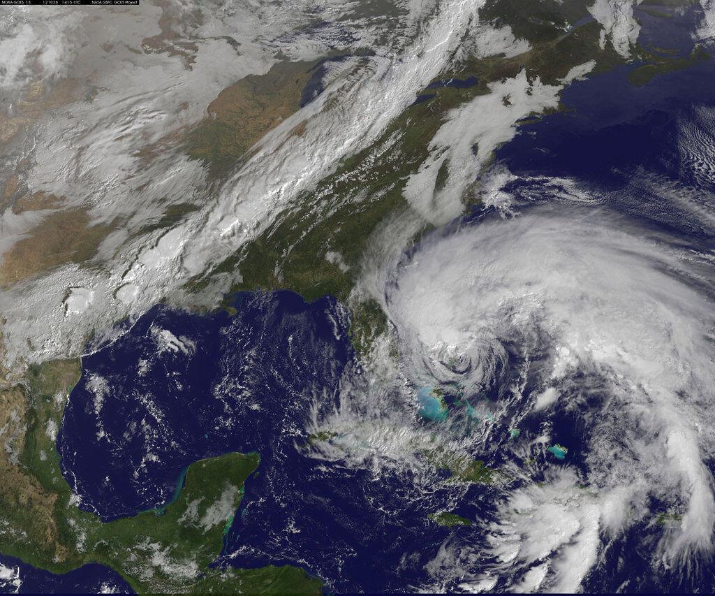
As the Southeast United States is struck by one of the first storms of the 2021 hurricane season, Texans should be preparing themselves now, instead of later. It only takes one storm to devastate a community.
Tropical Storm Claudette made landfall early Saturday morning in Louisiana, Alabama and Florida, leaving a deadly trail of damage before weakening to a tropical depression, according to The Weather Channel. Although this year is not expected to be as active as the record-breaking 2020 season, the National Oceanic and Atmospheric Administration, or NOAA, forecasts a range of 13-20 named storms and 6-10 hurricanes with 70 percent confidence. Experts from Texas A&M University commented on the resources available for Texans to prepare and how to interpret these forecasts.
“[The Brazos Valley] is far enough inland that we don’t have to worry about storm surge, but the damage we could see here is often associated with rainfall and wind,” Erik Nielsen of the Department of Atmospheric Sciences said. “As a storm comes into landfall it slows down, dumping a lot of rain in the same place, so we get flooding issues. The winds also weaken fairly dramatically, but they can still be above tropical storm force winds,or even higher,in our region.”
Storm surges can cause waters to rise far above the normal tide in coastal regions, causing flooding similar to Hurricane Harvey in 2017. This type of flooding, tornadoes and wind chill could all occur in the Brazos Valley as a result of a hurricane, Nielsen said, and evacuees from the coast often come to the area for shelter. But Texans should not rely on the classification or a category of an oncoming storm to set their expectations.
“Category is based purely on windspeed, it’s not based upon anything else,” Nielsen said. “And that’s where there’s a little danger in relying purely on the category for the damage a storm can do, because it’s the water threats from a hurricane that are actually the most damaging. And if you look at recent history, the most deadly.”
As storms develop this year, the most accurate and timely information can be found at NOAA’s National Hurricane Center, Nielsen said. The data on the site such as peak storm surge, rainfall potential and flash flooding potential will help capture the severity of the storm beyond its category. Brazos Valley residents planning travel to South Texas and the Gulf Coast should start checking these resources more intensely as their trip approaches, Nielsen said. A single forecast cannot capture how a storm develops over time.
“Until [a storm] starts getting its act together, it is very, very difficult to know what the end result is going to be,” Nielsen said.
Whether on the Texas coast or inland, having a disaster preparedness kit with items such as food, extra medications and a weather radio is one of the best ways to be ready for hurricane season.
“It doesn’t matter what type of scenario it is,” Monica Martinez, emergency management coordinator for the Office of Safety and Security at Texas A&M said. “Whether it’s a hurricane, power outage or a hazardous materials release where you would need to shelter in place at your home, it’s good to always have your disaster preparedness kit.”
Supplies can be kept in a car or at home, but should always be accessible, Martinez said. For students who likely do not yet have a preparedness kit, a variety of guides are available on the Federal Emergency Management Agency’s website.
Hurricane Strong is another initiative with similar guides, Nielsen said. Provided by the Federal Alliance for Safe Homes, there are resources relevant to the Brazos Valley including instructions for safety during a flood or power outage.
“Forecasts are often covering a broad area, so if there is an active threat, look at the data from the National Weather Service Forecast Office closest to you or your local media to get some idea of what the impact will actually be in that region,” Nielsen said.


