Familiarizing students with Geographic Information Systems research on campus is a main focus of the 2014 GIS Day at Texas A&M.
Andrew Klein, professor in the department of geography, has taught GIS on campus for more than 15 years. He said with at least three colleges and the university libraries actively participating in the planning process for the extensive and large-scale event — which began Monday and continues through Wednesday — GIS Day is a testament to the collaboration of faculty and students using these technologies across campus.
“Last year and this year, we have been fortunate to bring leading individuals from ESRI, the world’s leading GIS company, to campus and I think our efforts have impressed them, which I hope translates to their thinking we produce good students in the field,” Klein said.
GIS and similar technologies have become a fundamental component of everyday life. Klein said the key factor is that in today’s world much of the information includes a geographic x, y component.
“GIS and similar technologies are employed when you find the quickest route to your favorite restaurant using a map app on your cell phone or when you check to see what the real-time is around Houston,” Klein said.
Unlike other universities that participate in GIS Day, Texas A&M has turned the one day event, nationally recognized on Wednesday, into a three-day set of seminars and workshops, making it the largest GIS Day program in the country.
Miriam Olivares, geospatial coordinator in the department of geography and the College of Architecture, raises awareness of GIS throughout the university.
“Students at Texas A&M are lucky our university has many experts on many fields that relate to geospatial technology,” Olivares said. “Besides our outstanding GIS and remote sensing instructors, A&M faculty members from many fields of studies are integrating GIS into their teaching and research.”
Olivares said students at A&M use GIS in their courses in veterinary medicine, political science, planning, industrial distribution, water management, real estate, landscape architecture and many other fields.
Michael Bishop, geography professor, said for students, important impacts of the program include high-impact education opportunities.
“It’s critical that we have a reasonably seamless curriculum so that students don’t fall through the door so to speak, because there might be a huge disconnect technologically from one class to another,” Bishop said. “That’s a challenge.”
Georgeanne Palmer, geography junior, said by taking GIS courses and learning from faculty instruction, GIS has been an eye-opening experience.
“Learning a newer technology and making a map of any sort that can aid a person’s need is great,” Palmer said. “Texas A&M continues to provide a growing amount of opportunities to expand my GIS abilities like no other.”
Students and staff can still register for GIS Day events by visiting gisday.tamu.edu. GIS Day events are free and open to the public.
Battalion reporter Sarah Medrano contributed to this report.
Event pinpoints GIS research
November 17, 2014
Sarah Lane — THE BATTALION
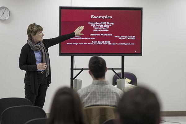
Career coordinator Marilyn Yeager gives GIS students resume guidelines at Evans Library Monday afternoon.
0
Donate to The Battalion
$1765
$5000
Contributed
Our Goal
Your donation will support the student journalists of Texas A&M University - College Station. Your contribution will allow us to purchase equipment and cover our annual website hosting costs, in addition to paying freelance staffers for their work, travel costs for coverage and more!
More to Discover


